June 1, 2010 - I absolutely was NOT expecting the first thing I found at the trailhead of the Otay Sweetwater Refuge. Talk about pleasant surprises. This Steel Bridge you see here is not just any old bridge. This is a "Historical" Bridge! The steel Sweetwater Bridge, built in 1929, is a remnant of Old Highway 94 and a walk across it will bring you to this GREAT trail. After crossing the bridge I found the little gap, you see here, between two rocks and I was on my way! The first half of the hike had the tree-lined Sweetwater River (or should we say creek?) to my right, and grasslands and hills to my left. A short way down the trail I encountered a couple of different Jamulians out walking their dogs. Very nice people with interesting things to share about the region. As we were talking, a distant ambulance siren sounded and triggered what seemed to be a "herd" of coyotes yelping from a "very, very" short distance away from us in the nearby trees. Beach Boy: "Run away, run away!" Country Locals: "Yep, dem's coyotes a'ight." Good thing I'm good at looking cool on the outside! After a friendly reminder from my new friends about rattlesnakes, I bid them good day and hiked onward past a wooden bridge that crosses back over to the north side of the river. Quite a ways beyond the bridge I did a little off trail exploration. After tromping, climbing and sliding my way through what may have been a trail suitable for the rare Southern Cal rough terrain goats for awhile, I said to myself, "Self, what the heck do you think you're doing?" My answer was to double back and climb up a mountain bike path heading south. I knew what it was because I just saw a mountain biker pass me heading in that direction. As I climbed upward It dawned on me that I could probably follow this trail for about 14 miles in a southweseterly direction and sneak my way in the back door of "Fort Knox." If you actually read this blog, as compared to just looking at the pretty pictures, then you know I'm referring to the Sweetwater Reservoir (Hike #4). Deciding that five miles was probably going to be enough for me today, I took a picture and head back down. In that picture, if you look closely, you can see the wooden bridge amidst the river growth. So, what did I do ? (drumroll...) I "crossed" the bridge. On the other side there was a parrallel east-west trail. After heading west for a little while I realized I really "was" heading for the reservoir so I turned around and looped back in the direction of the steel bridge. It was on this part of my walk that I had my very first rattler encounter. I didn't "see" it, but hearing it, in all it's presumed fury, just to my right in the low dry grass, was enough for my "Beach Boy" inclinations to kick in. I left more rubber on that trail than a nascar at the Indy 500. About half way back the path turned into a gravel trail and eventually a paved road. For that reason, if I did this hike again I would return on the south side trail. In this last photo you will see the small parking lot right before the bridge. This 2 1/2 hours well-spent! |              |
Wednesday, June 9, 2010
Otay Sweetwater Refuge (#9)

Green Valley Falls (#8)
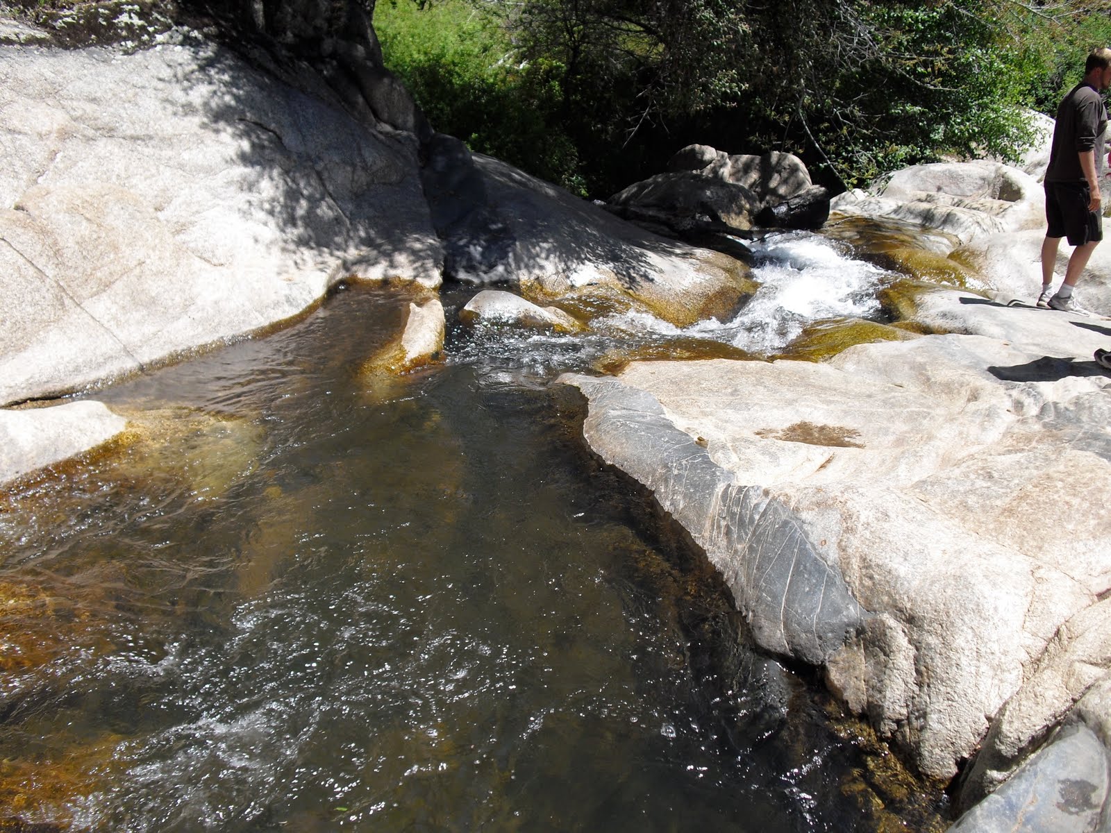
| May 29, 2010 - It's not far down the road from Stonewall Peak, heading back toward home, that you will find another trail leading to a great wet spot for cooling down your toes (freezing them actually) after a warm hike. Green Valley Falls is a popular spot this time of the year when there is still plenty of water flowing. I believe there is actually miles of trail to be had here but we only made it the half mile to the falls. The trail to the falls, as short as it is, is really very nice. Not very far down the path you will run into the upper part of the falls which can be a nice spot to stop and play around a little bit. Fun for hopping around on the rocks and splashing around. We didn't do that though - we went directly to the bottom. At the final destination there are some nice little pools to wade in and a mini water slide. There is also a rock ledge off of which one can jump (hopefully with good aim) into a small, but "mostly" deep enough, pool of water. We didn't do that! MAP |   
  |


Tuesday, June 8, 2010
Stonewall Peak (#7)
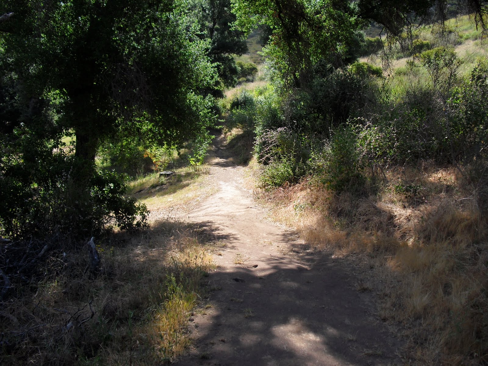
May 29, 2010 Okay, as far as "hiking" goes, most San Diegans know that Cuyamaca Mountains rock! Many, many trails can be found there and eventually I plan on getting to most of them (did I tell you this is a long-term project?) One Cuyamaca trail that my family and I have enjoyed over the years is the 2 mile journey that takes you to the top of Stonewall Peak. The trailhead (top picture) to Stonewall Peak is right off of Highway 79 just south of Lake Cuyamaca opposite Paso Pichaco Campground. I'll bring you back here to Paso Picacho in the future to do the Azalea Springs Trail hike (though it is nowhere near as appealing as it once was before the Cedar fires.) The hike starts off shady, as you can see, but is overall a sunny walk ever since the fires. Fortunately the majority of the trail is a series of switchbacks making the climb much more bearable. There are only a few small stretches of the kind of incline that makes you need to stop and catch your breath. Once you get far enough up the side of the peak you start getting some good views of Cuyamaca Lake (see the fifth picture down). I must admit that this was a particularly fun walk for me since I had the company of my family. One realization that came to me is that as kids get older they complain much less. As you get close to the summit there are some really cool climbing rocks. At least the "kids" enjoyed bouncing around on them (I tried not to look, avoiding the over-protective parent syndrome telling them what was, and wasn't safe to do). Just shy of the top there is a set of stairs with a rail that guides you safely to the "tippity" top... and once you get there, what a view! 360 all around! Kind of like the TOP OF THE WORLD! All I can say about the 2 mile return trip is that it works a different set of muscles - and the next day you know which ones those are. |           |
Sunday, June 6, 2010
Stelzer Park Trail (#6)
I hadn't planned on hiking near Wild Cat Canyon Road again so soon. However, since I had to drive all the way back to Oak Oasis Trail to recover my abandoned walking stick from last night's walk, it only made sense that I make my next hike at another nearby trail.
It just so happens that on the right hand side of Wild Cat Canyon Road, a mere two miles before Oak Oasis, one will find this shady little spot known as
The reason I know about Stelzer is that my wife, and the rest of her first grade team, have been bringing their first graders here for the past several years. So, I figured that if THEY can do it, so can I!
The two mile trail itself looped out, up, around, and back to the park. I could have made the trail a little longer had I not missed the path up to the two nearby peaks. That's okay, that sounded like too much work anyway.
This would be a great place to go for a family outing. Lots of picnic tables, grills, a playground, and the trail really is very nice and appropriate for all ages. MAP


It just so happens that on the right hand side of Wild Cat Canyon Road, a mere two miles before Oak Oasis, one will find this shady little spot known as
The reason I know about Stelzer is that my wife, and the rest of her first grade team, have been bringing their first graders here for the past several years. So, I figured that if THEY can do it, so can I!
The two mile trail itself looped out, up, around, and back to the park. I could have made the trail a little longer had I not missed the path up to the two nearby peaks. That's okay, that sounded like too much work anyway.
This would be a great place to go for a family outing. Lots of picnic tables, grills, a playground, and the trail really is very nice and appropriate for all ages. MAP



Thursday, June 3, 2010
Oak Oasis Trail (#5)
| May 27, 2010 - Wild Cat Canyon is a very special road to me. Why? Because it takes me to one of my favorite poker rooms in San Diego. Wild Cat will also get you to this really great hiking spot - The Oak Oasis Trail. My wife Rose and I hiked this four mile trek a few hours before sunset and we both liked it very much. The trail access is located on the left side of the road (going north) only a few miles before getting to the Barona "gaming facilities." There is a small gated parking lot at the trailhead (top picture). Hopefully you'll get a sense of why I like this trail so much from the pictures. The key word here is "variety!" The trail goes from chaparral to oak grove to rocky mountain side to lake view to poison oak laden foilage to meadow and back. It is certainly well maintained and clearly marked. It was nice to see that the Oak Grove has rebounded so well since the Cedar fires of 2003. The contrast of the burned trunks covered with the new growth kind of had a surreal effect to it. The View of the San Vicente was great. On one of my next hikes I plan on coming in from the other side of the reservoir to see what it looks like from over there. The oak trees aren't the only noteworthy plants in Oak Oasis Open Space Preserve. The cactus that you see here was pretty cool, and the poison oak, which was running wild, certainly drew our attention. Wild lavender was also abundant. "Creeped out" would be an accurate description of how Rose felt about walking through the meadow. I have to admit that it was very lush and dense so that at times we were not sure whether we were still on the trail. When a sizable animal den appeared within a couple of feet from the trail our tempo almost doubled immediately. We both agreed how beautiful the meadows were - from a distance! Interesting to know: I left my most AWESOME walking stick (still looking for a name for him by the way) leaning on the post at the trail entrance. I returned the next morning at 6:00 a.m. to find him waiting obediently, but with a perturbed look on his face. I promised him I would not let that happen again. |       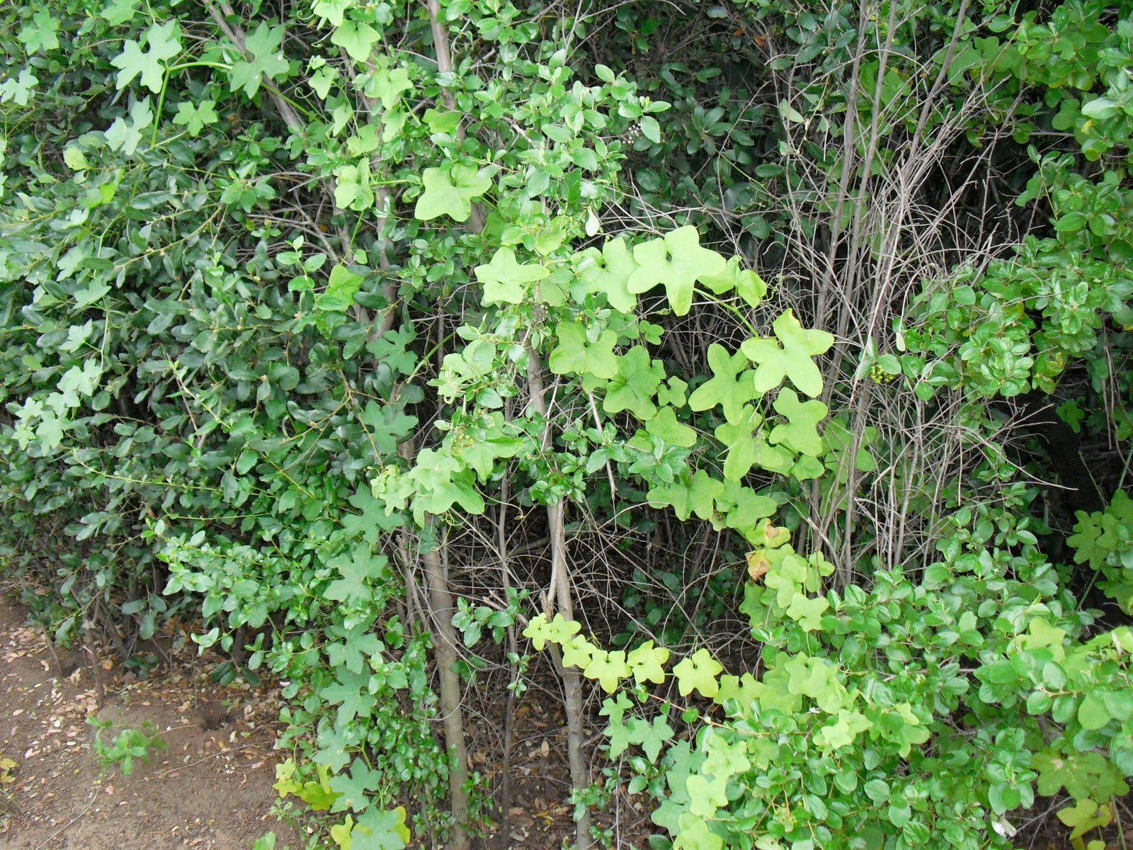   |
Tuesday, June 1, 2010
Sweetwater Reservoir (#4)


 May 26, 2010 - I was actually fairly excited about this walk at the Sweetwater Reservoir in Spring Valley because I've seen it from a distance for so many years. This hike turned out to be a bust however. As you'll see from the pictures, on this particular day Sweetwater Reservoir may as well have been Fort Knox. My online investigation led me to this trail head (top picture) at the Sweetwater Summit
 Campground on San Miguel Road in the northeastern edge of Bonita. So far, so good right? The next picture shows you what I found - a nice trail with a closed gate. Tip #1: do not come for this hike unless it's Saturday, Sunday or Monday.
  But wait! I can travel straight on the road and find the trail that goes around the s
 outh side of this pristine waterhole. As you can see, I found barbed wire fence, a small dam (pretty neat actually; glad it held up as I walked by), more barbed wire and... duhn, duhn, duhn... another closed gate. The good news? Our water supply here on the southwestern part of the nation is safe and sound. I guess that's why its pristine.
MAP
Subscribe to:
Posts (Atom)