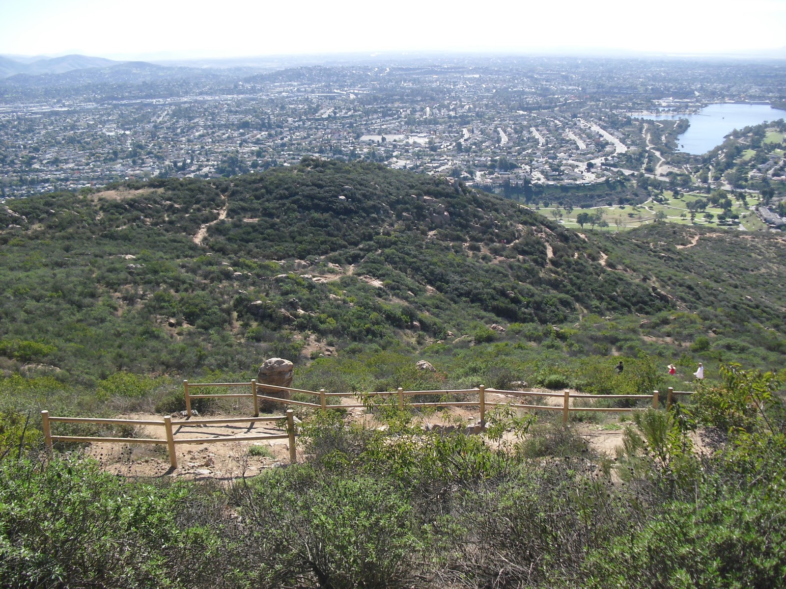
December 30, 2010 - It seems like Wilson and I keep on finding our way back to Mission Trails Regional Park. While I have hiked to the top of Cowles Mountain once in the past, that was before I started photo-journaling our hikes on this here bloggy-thingy. Cowles is a rocky, switch-backy, uphill all the way kind of trail that really gets your heart pumping. We started our way up the hill at precisely 10:00 a.m. on this beautiful blue-sky day. A mile and a half to the top, this trail is never a lonely one. In fact it is quite popular and all sorts of people make their way here. Fortunately, today being a Tuesday, it wasn't too crowded. Some portions of the trail are a bit rocky, as you can see, which actually makes it a bit more interesting the way I see it. When you look to the south, Lake Murray stands out. Wilson and I visited there back in July (see hike #24). The distant views looking off to the north and east are better if you cut off the nearby civilization and highways and the such. Wilson and I enjoyed hanging out at the top. The views toward the ocean were incredible. It was clear enough that we could see not only San Clemente Island, but Catalina Island as well. Bad news though! The shots I took of the good ol' Pacific did not come out. Bummer! Back up plan: a photo of a handy-dandy nearby placard displaying what you would have seen if my photos did come out. Lame, I know. If you look carefully you will see a few little bumps on the horizon and those would be the Coronado Islands. The final leg of the return trip had the visual effect of coming in for a landing in a small aircraft. Back to reality! Another Great Hike! MAP |


|
Tuesday, November 30, 2010
Cowles Mountain (#42)


Monday, November 29, 2010
Kumeyaay Lake (#41)
November 18, 2010 - Wilson and I went back to Mission Trails Regional Park to hike the short trail to, and part way around, Kumeyaay Lake. The well-groomed trail leads to a pleasant little campground with some decent tent sites. The small lake, at one time reduced to a gravel pit, has been very successfully rehabilitated and is now lush and vibrant with both flora and fauna. Wilson liked it and he's not always easy to please. We continued walking along the trail... ...and discovered that there were no more shoreline access points or even views of the lake. Eventually we ended up within eye shot of some Santee residential development... ...so we turned around, heading back... ...stopping to reflect upon what is really important about these kinds of open spaces. Before we left we spied the destination of our next visit to Mission Trails Regional Park - Kwaay Paay Peak. A Short but Fun Hike! MAP |                  |
Wednesday, November 10, 2010
Old Mission Dam/Oak Canyon Trail (#40)
October 29, 2010 - This was our second visit to Mission Trails Regional Park. We came back to visit the Old Mission Dam... ...and then hike the Oak Canyon Trail. The Old Mission Dam was the first major irrigation project on the Pacific Coast. The concrete dam and flume was constructed between 1813 - 1816 to divert water from the San Diego River for about 6 miles as a source of water for crops and livestock at the San Diego Mission de Alcala. Moving right along, we hit up the Oak Canyon Trail. All the trails in MTRP are very well maintained. After reading caution signs warning of mountain lions Wilson and I were on our way. It didn't take us long to find this friendly old Oak. Cool, a tunnel! Hope there's nothing living in there! Wilson thought we hit a dead end and suggested we turn around. I was starting to think he was correct... ...until I found the path we should have been on. Interesting bridge. I understand that at times this is a rushing waterway. "Hey look!" says Wilson. "We could probably turn left here and shortcut back if we turn left up this steep rough trail." "I don't know, Wilson. Sure looks steep and rugged, and it's not marked. Besides that I think I see some Mountain Lion tracks," I retorted. "Don't be a wimp! Let's do this thing." was Wilson's insistent response. Now I had to admit that when we reached the top there was a great view of Highway 52... ...and the view east was not so bad either. I should have followed my own instinct, however, because that trail definitely was not going to take us anywhere we wanted to be. Now, unfortunately, I hadn't worn my hiking boots. Instead just a treadless pair of tennies were responsible for helping me negotiate the steep gravely trail back down with Wilson doing his share of the work. With my attention focused on the ground I was slipping on, I spied the clearly imprinted mountain lion print. Now, of course, Wilson was doubting. He muttered that someone had probably walked their dog up there until I reminded him that it had rained two days ago and if someone had walked their dog we would be seeing their footprints as well. Wilson sped up and we got back on the trail heading home. I did my best to keep up with him! Glad to be back! Another Fantastic Hike! |                                    |
Subscribe to:
Posts (Atom)